RO-FLOODS
Strengthening the capacity of the central public authority in the water field in order to implement the 2nd and 3rd stages of the 2nd Cycle of the Floods Directive.


Since 2019, the Ministry of the Environment, Waters and Forests, as a project leader, having the ”Romanian Waters” National Administration
as a partner and with the support of the World Bank, has been carrying out the project „Strengthening the capacity of the central public authority in the water field in order to implement the 2nd and 3rd stages of the 2nd Cycle of the Floods Directive – RO-FLOODS”, SIPOCA Code 734 MySmis Code 2014 130033.
As an EU Member State, Romania is implementing the EU Floods Directive. This Directive requires Member States to follow 3 steps in order to ensure the flood risk identification and mitigation as per the existing international standards and best practices. All such information is embedded into the Flood Risk Management Plans (FRMPs).
1st Stage
The 1st stage of the 2nd Cycle of the Floods Directive, the Preliminary Flood Risk Assessment (PFRA), was conducted by the water management public authorities and was completed back in 2019. Within this stage, one identified the significant flood events and APSFRs – Areas of Potentially Significant Flood Risk. The PFRA Reports can be consulted here.
The 2nd stage, Preparation of Flood Hazard and Risk Maps (FHRM) for each APSFR, and the 3rd one, Preparation of FRMPs, for each River Basin Administration (11) and one for the Danube River, are developed under the project RO-FLOODS with the World Bank’s support.
Activities conducted within the project are aimed at the revision of FHRM from the 1st cycle of the Floods Directive and at the preparation of new maps for the APSFRs identified during the 2nd cycle, the update of FRMPs, the development of a functional GIS portal, the adoption of FRMPs from the 2nd cycle by Government Decision and the development of improved knowledge and skills related to flood risk management for the relevant responsible public authorities.
In order to improve FHRMs and FRMPs, under the project, one has prepared methodologies on the flood hazard modeling and mapping, floor risk assessment and mapping, development of the programs of measures for flood risk mitigation, considering the international best practices. Besides, the database and the information (specialized studies) necessary for the flood risk management have been developed.
In order to enhance the interaction with the relevant stakeholders in the field and to increase the awareness on the flood risk, one has developed modern communication tools (video clip, brochures, web[CF2] site, online GIS viewer for FHRMs) and there are events in progress related to the project activities both with the public authorities and with non-governmental organizations (NGOs) and civil society organizations (CSOs).
Under the project, one has created a technical advisory group made up of representatives of relevant responsible central public institutions in order to improve the inter-institutional coordination and to encourage the engagement of the relevant stakeholders.
From the very beginning of the project, one has organized activities for training and strengthening the skills related to flood risk management.


2nd Stage
Flood Hazard and Risk Maps
The revision and preparation of new FHRMs involve a complex and time-consuming process. Complex sets of data and information (on topography, hydrology, land use, flood protection infrastructure) are processed by dedicated hydraulic modeling software in order to obtain the results on the hazard magnitude (extent, water depths, water velocity). Based on the results on hazard magnitude, on the information regarding the population and objectives in the potentially flooded areas and their vulnerabilities, the flood risk is assessed. Teams of international and local experts are involved in this process.
Unlike the 1st cycle, under the 2nd cycle of the Floods Directive, several flood sources (fluvial, pluvial, sea) are examined and the flood risk will be assessed in quantitative terms (monetary value). Moreover, one will also examine a scenario integrating the climate change effects.
In order to facilitate the FHRM assessment by the relevant stakeholders, a GIS viewer has been developed, enabling the view of different results on hazard and risk and providing feedback on their quality.
The FHRM versions that have passed the procedures prepared for quality control will be posted on a web platform, with a friendly interface, in order to enable all stakeholders, as well as citizens to view the hazard and risk sizes proper to an APSFR.
After endorsement of FHRMs by River Basin Committees and then by the Inter-ministerial Committee on Water, they will be reported to the European Commission.
3rd Stage
Preparation of Flood Risk Management Plans
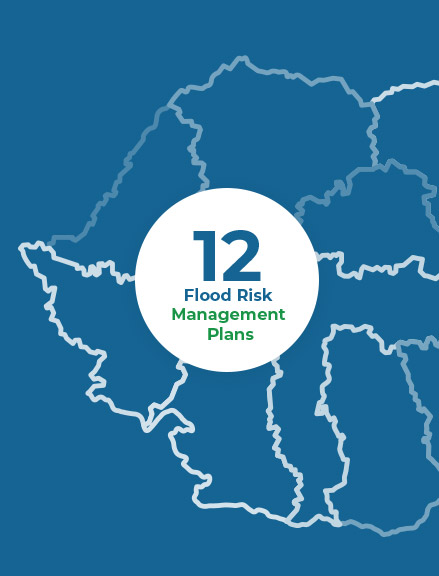
The update of the 12 FRMPs is made in coordination with the River Basin Management Plans and considering the EC recommendations, as well as the relevant best practices.
The FRMP objectives have been defined and agreed upon within the technical advisory group. Programs of measures for flood risk mitigation are the core of such plans. The methodology prepared within the project has 3 milestones:
- screening (to identify potentially viable measures for flood risk mitigation at the level of each APSFR),
- preparation of strategies at APSFR level (grouping measures in packages of measures called Alternatives and their relevant multi-criterial and cost-benefit analysis to determine the most advantageous Alternative at APSFR level);
- preparation of strategies at River Basin Administration level, and, respectively, for the Danube River. Within such strategies, major integrated projects will also be conceptualized.
One will pay a special attention to the integration into the strategies for flood risk mitigation of green infrastructure and nature-based solutions related measures. Besides, in order to determine the advantageous Alternatives, the climate change impact will also be considered.
In addition to the flood protective measures, one will define measures at national level (consisting in programmes aimed at improving the flood risk management, measures on the improvement of the knowledge base etc.) and a set of measures on preparedness for the response during the floods and the post-flood recovery.
Results obtained under each stage are presented to stakeholders and their active engagement is expected for their finalization.
Besides, FRMPs are subject to a Strategic Environmental Assessment (SEA), aimed at identifying and examining their potential negative effects on the environment, prior to adoption.
After the endorsement of FHRMs by the River Basin Committees and then by the Inter-ministerial Committee on Water, FRMPs should be approved by Government Decision and reported to the European Commission.

 Weather Warnings
