Guide for using the online web viewer for the Flood Hazard and Risk Maps
Using the Search Box
The Pan Tool

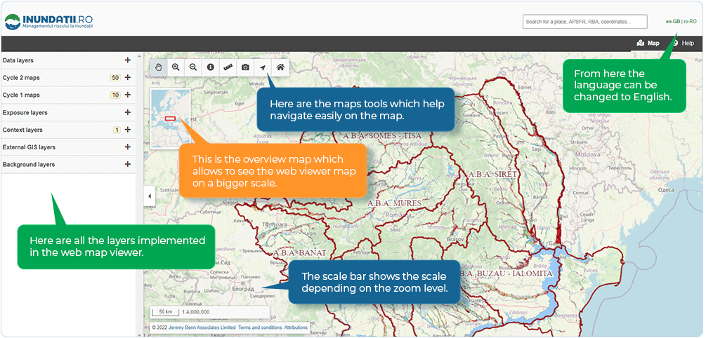
The first tool is called pan tool and it is active by deafault. Same functionality can be used by pressing and holding the scroll button on the mouse.
Zoom in and Zoom out Tools

The next tools are called zoom in and zoom out. Same functionality can be used by using the scroll button forward or backward.
Flood Maps Query Tool

In order to use the Flood maps query tool, it is necessary to enable some of the layers in the web viewer
As seen in the video:
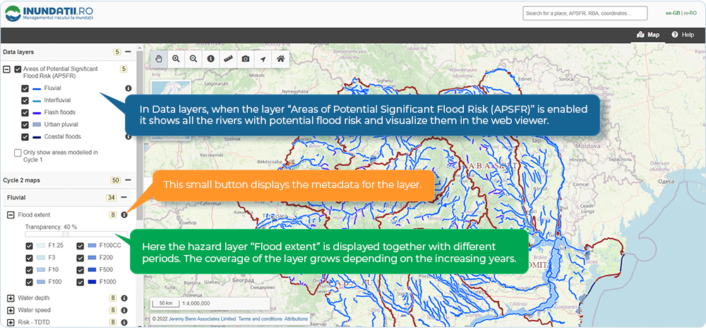
- 1st from the Data Layers – Areas of potential flood risk was enabled.
- 2nd from Cycle 2 Maps – Fluvial was enabled. Then Fluvial Depth which gives information about the fluvial depth hazard based on the colours from green to red.
- 3rd by using the Flood Maps Query Tool different information about the exact place was shown.
Measure Tool

The measure tool helps measure different distances in metres.
Download Map Screenshot Tool

Download map snapshot tool makes a screenshot of a specific place from the web viewer.
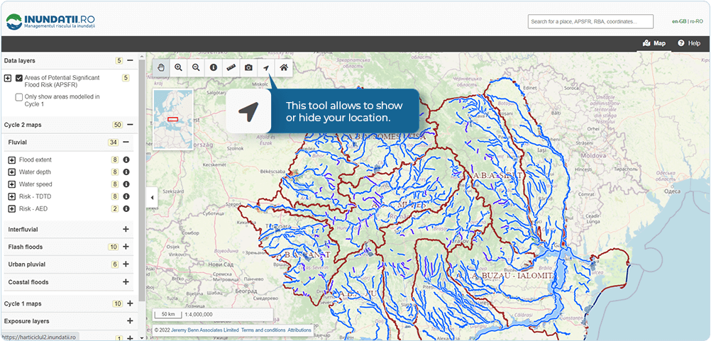
Reset Map View

Reset map view tool returns the main canvas in starting position.
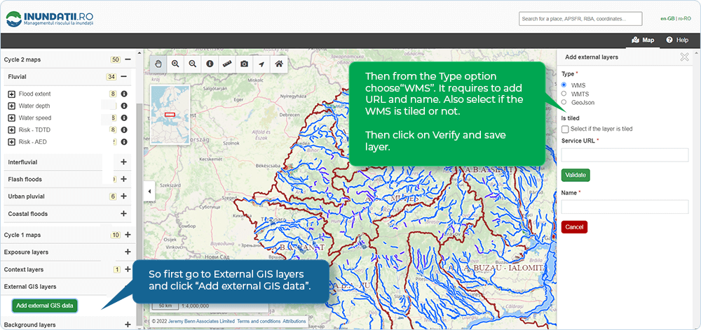
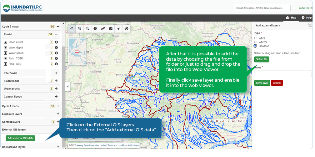
Adding External GIS Layers
Adding WMS layer into the Web Viewer
Add OpenStreetMap into the Online Web Viewer via WMS.
Adding JSON into the Web Viewer
Add Romanian railroads via JSON into the Web Viewer.
 Weather Warnings
